STRATEGIC VISIONING OF LAND TRANSITIONS IN THE SAN JOAQUIN VALLEY
San Joaquin Valley, California
Client/Partner: Environmental Defense Fund
Team: Alison Hirsch with Jade Orr and Yuliang Jiang
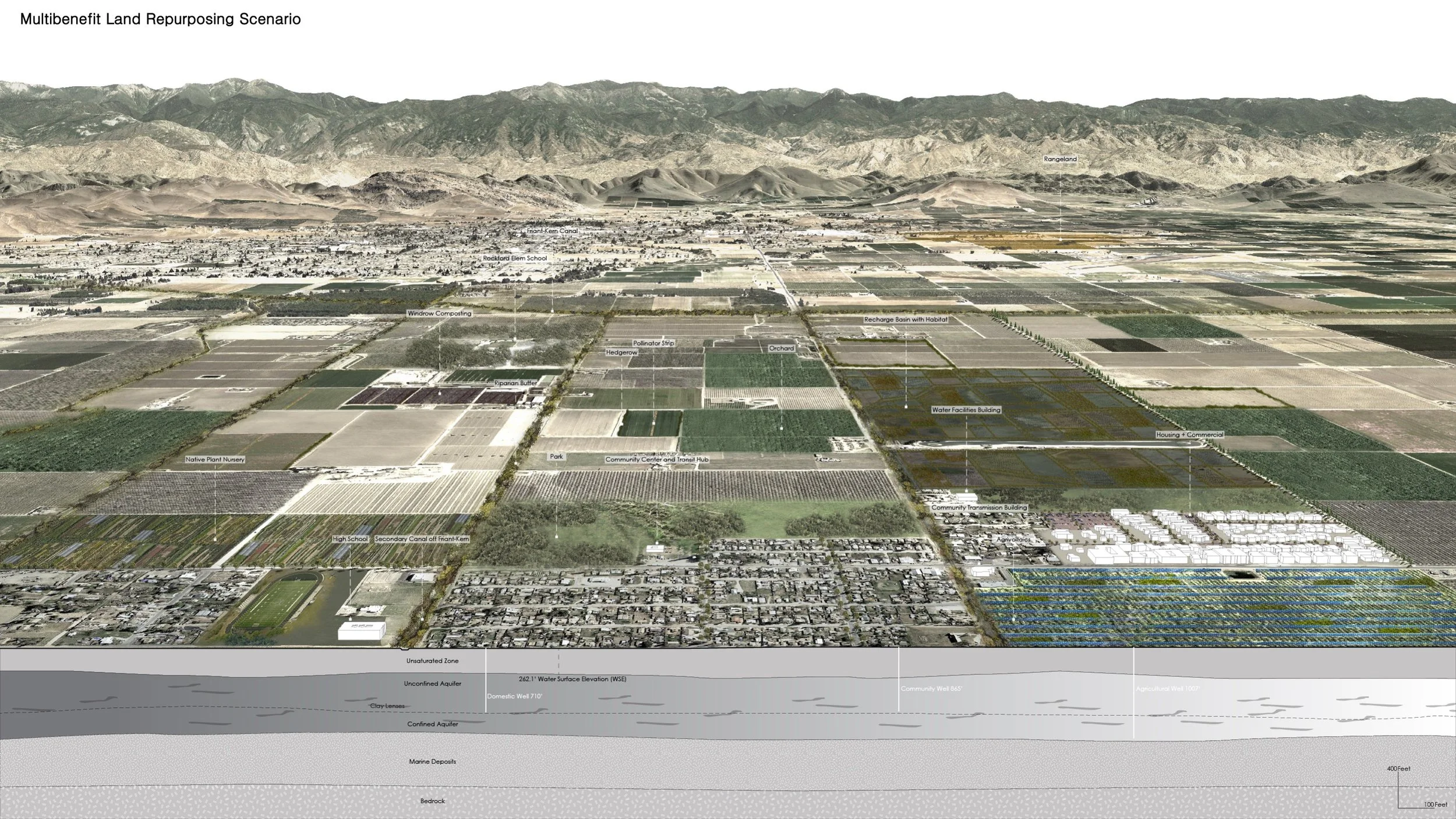
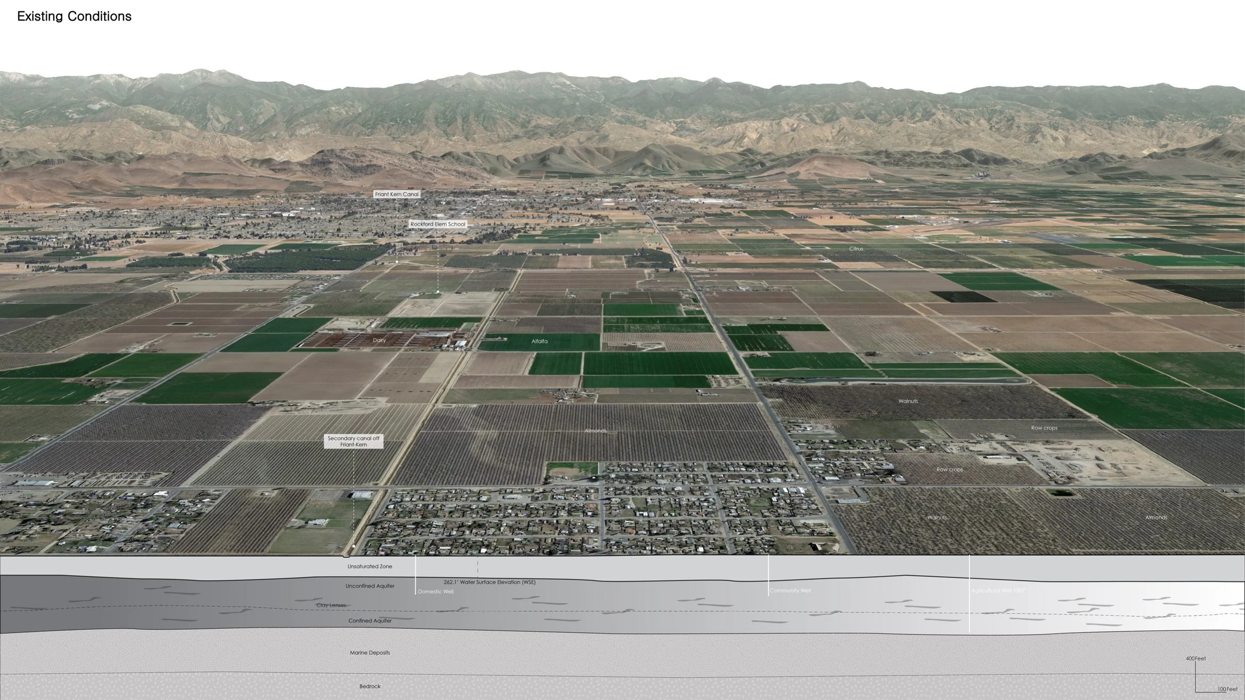
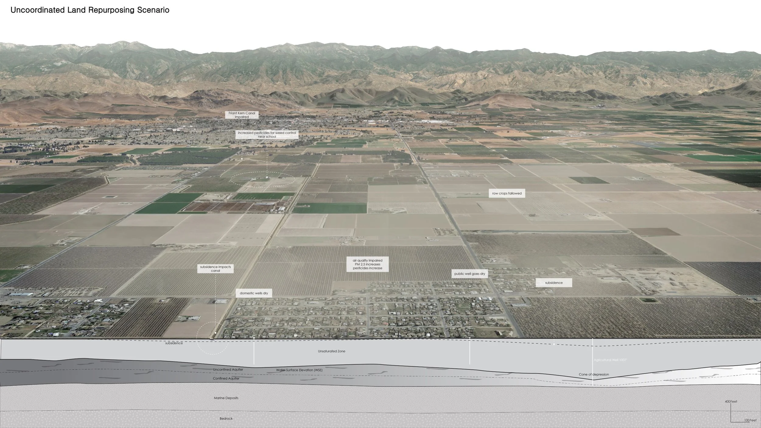
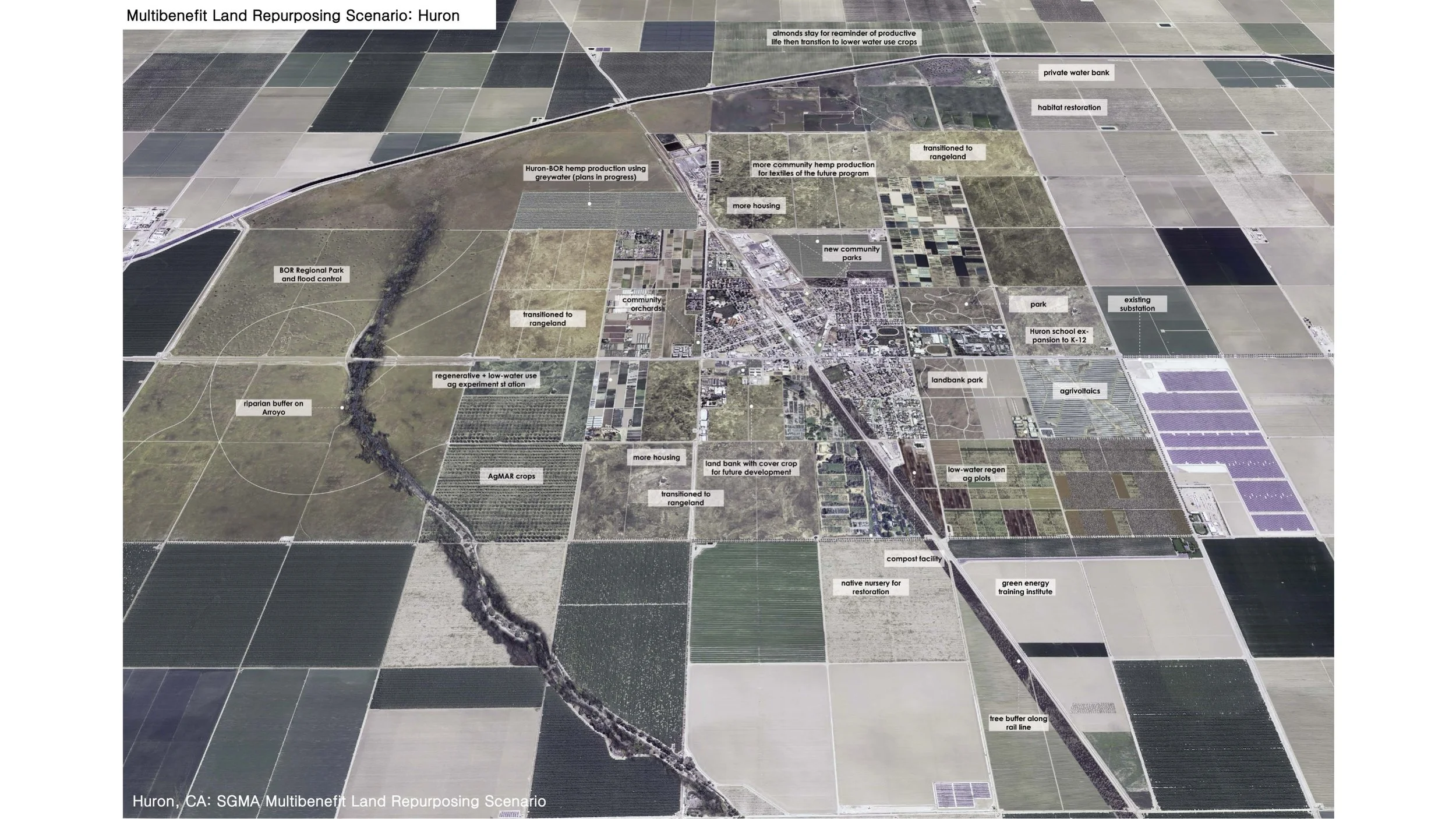
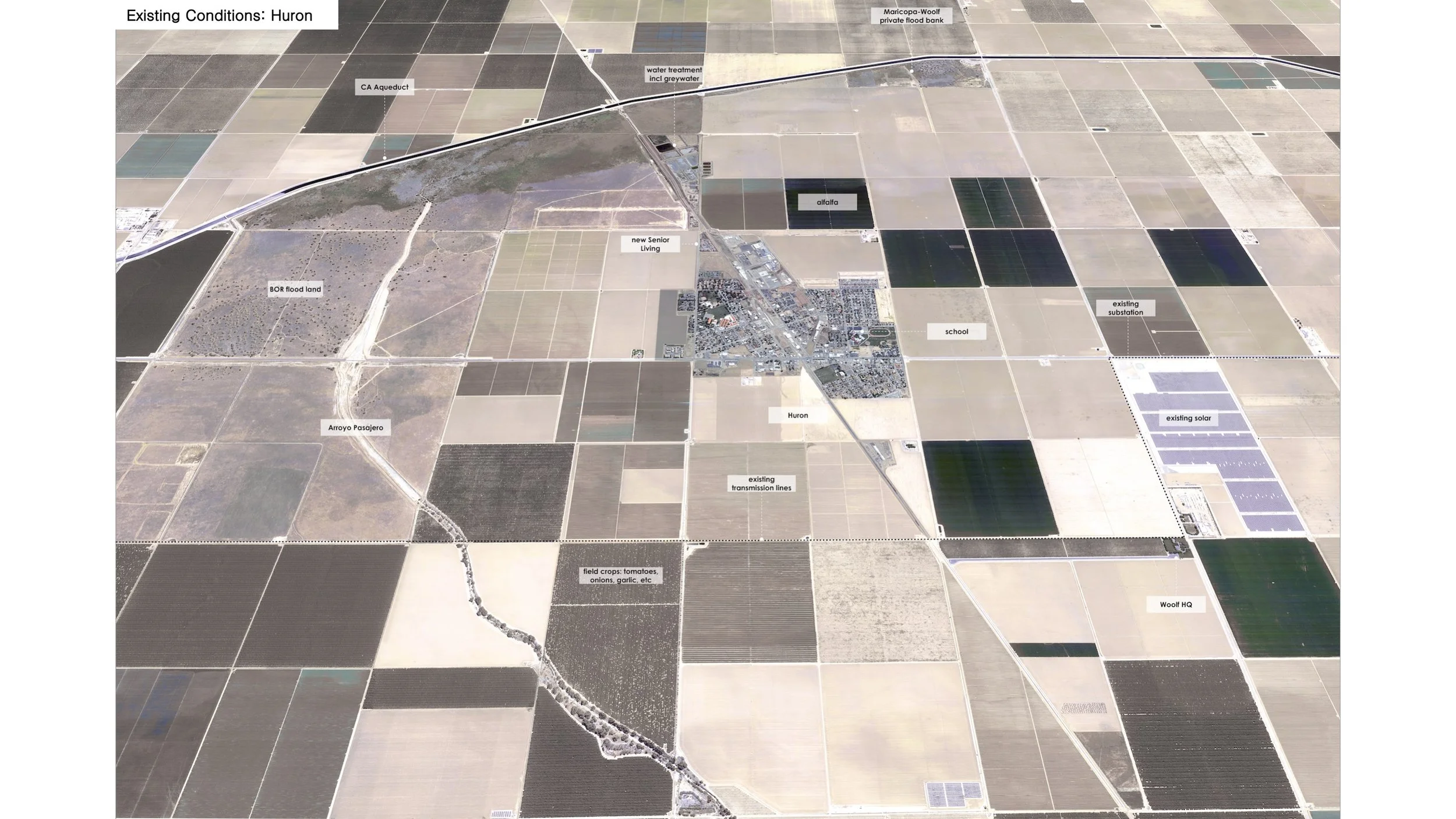
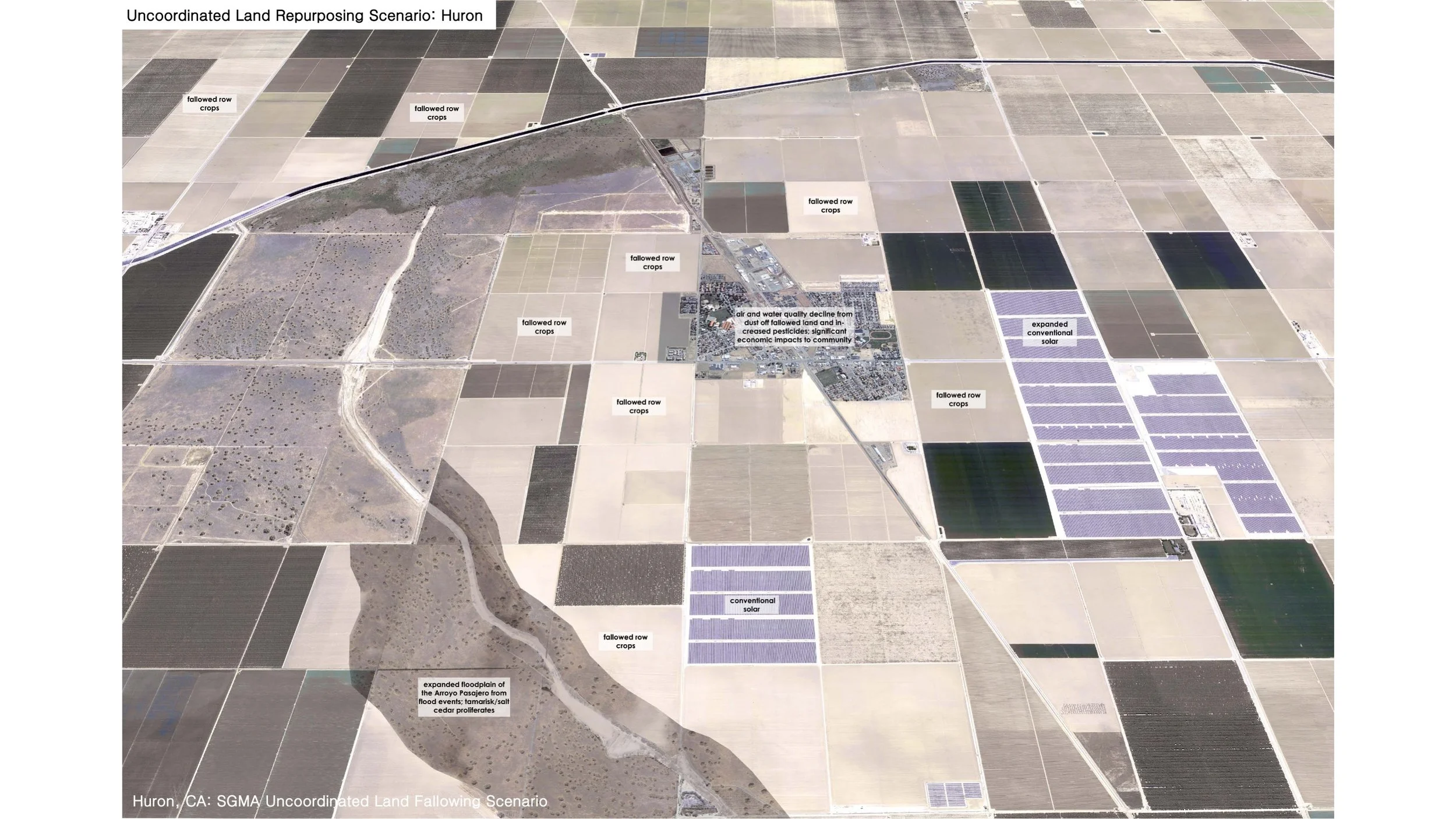
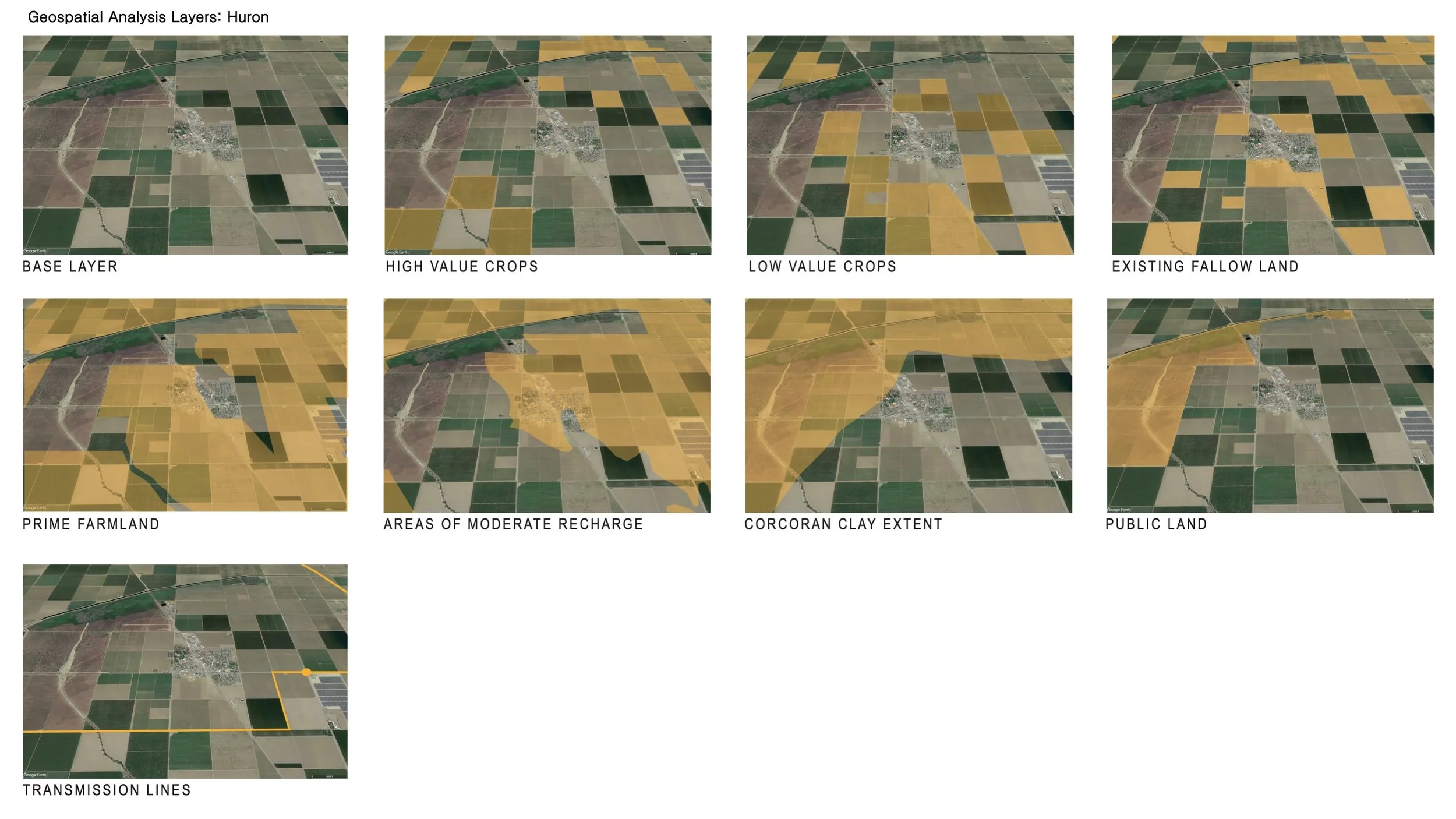
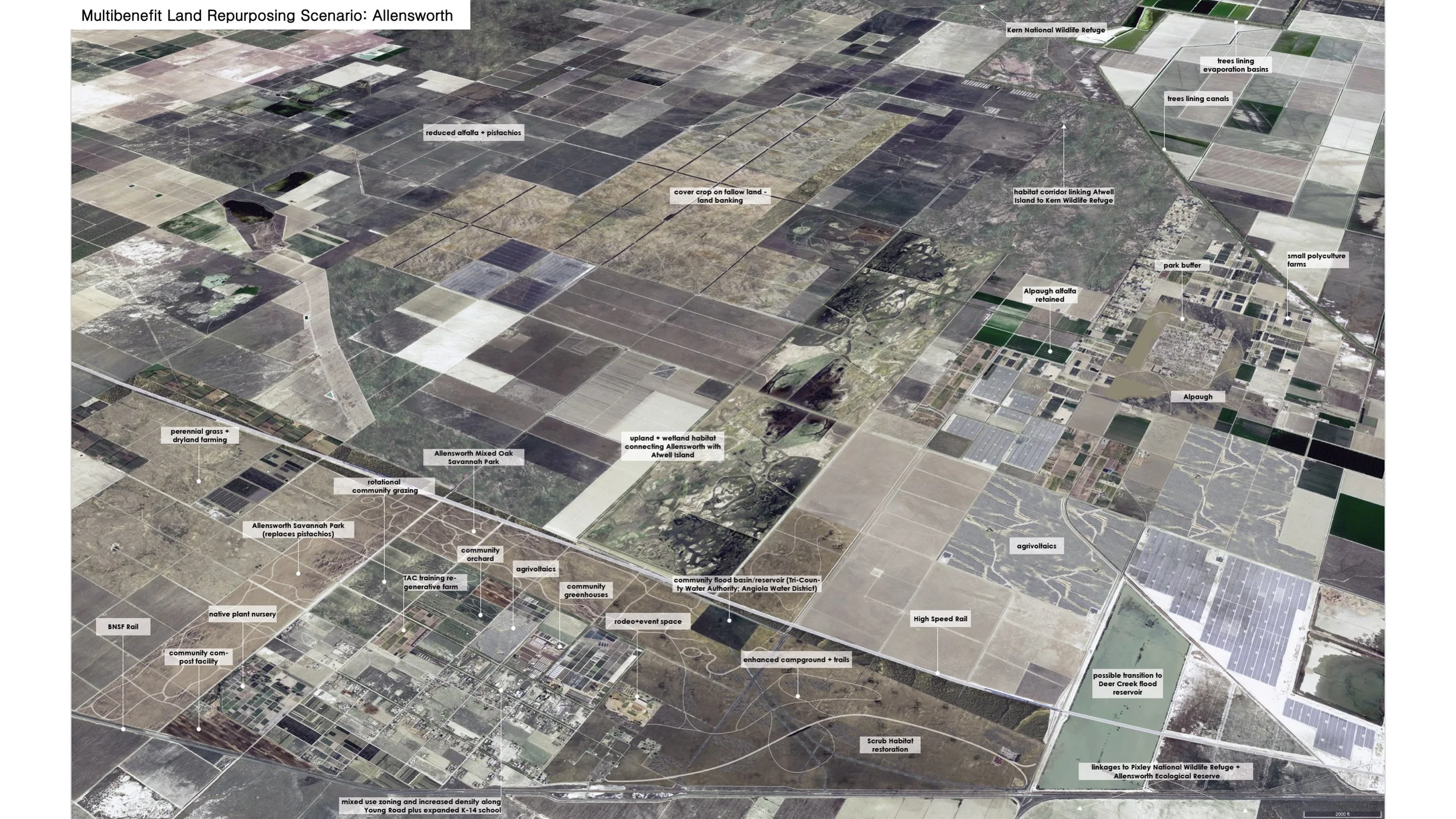
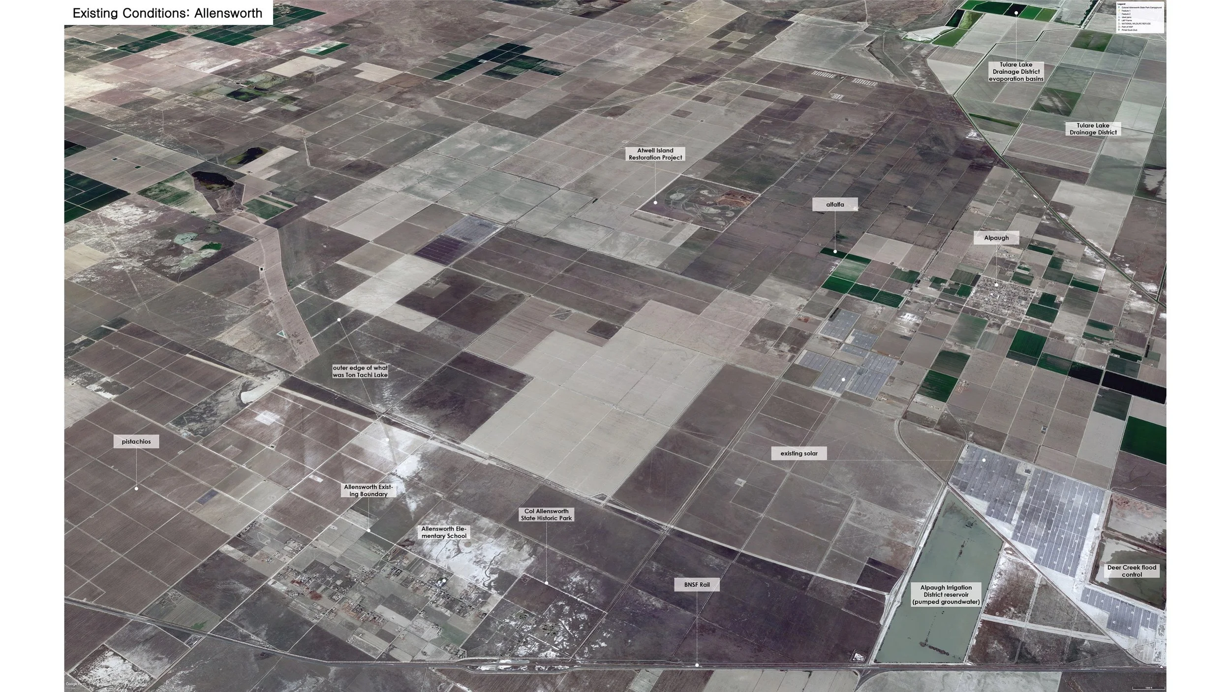
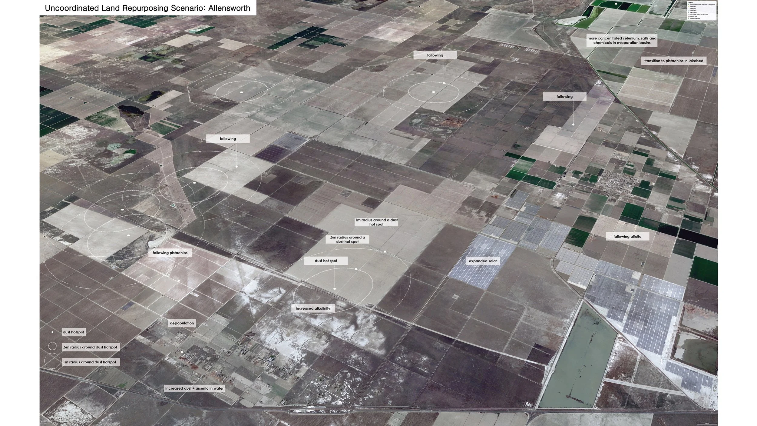
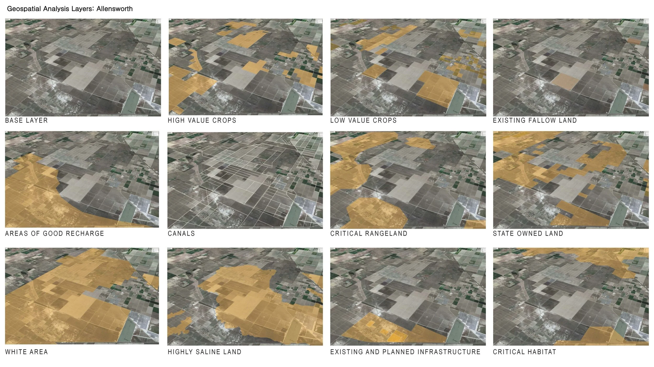
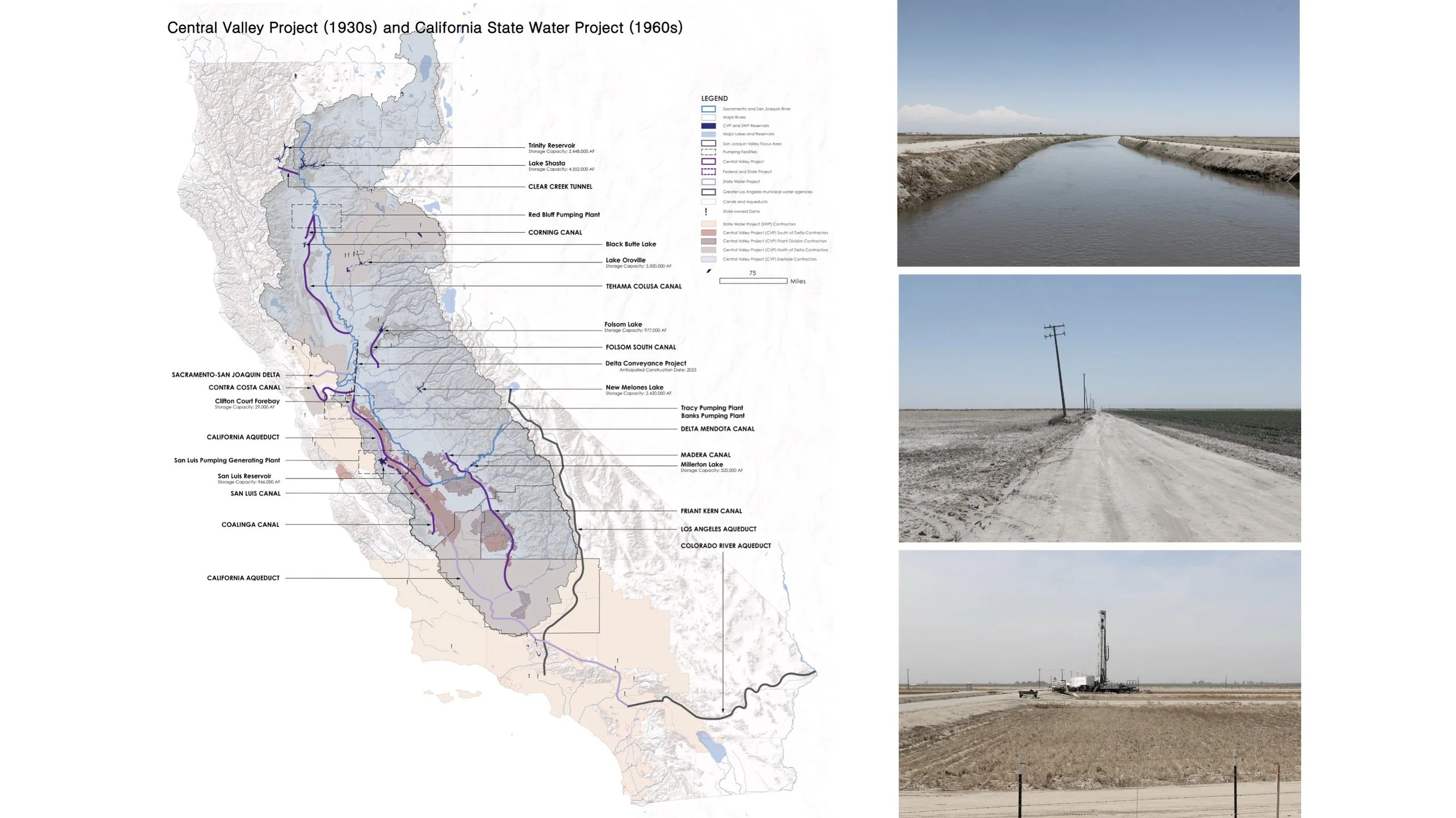
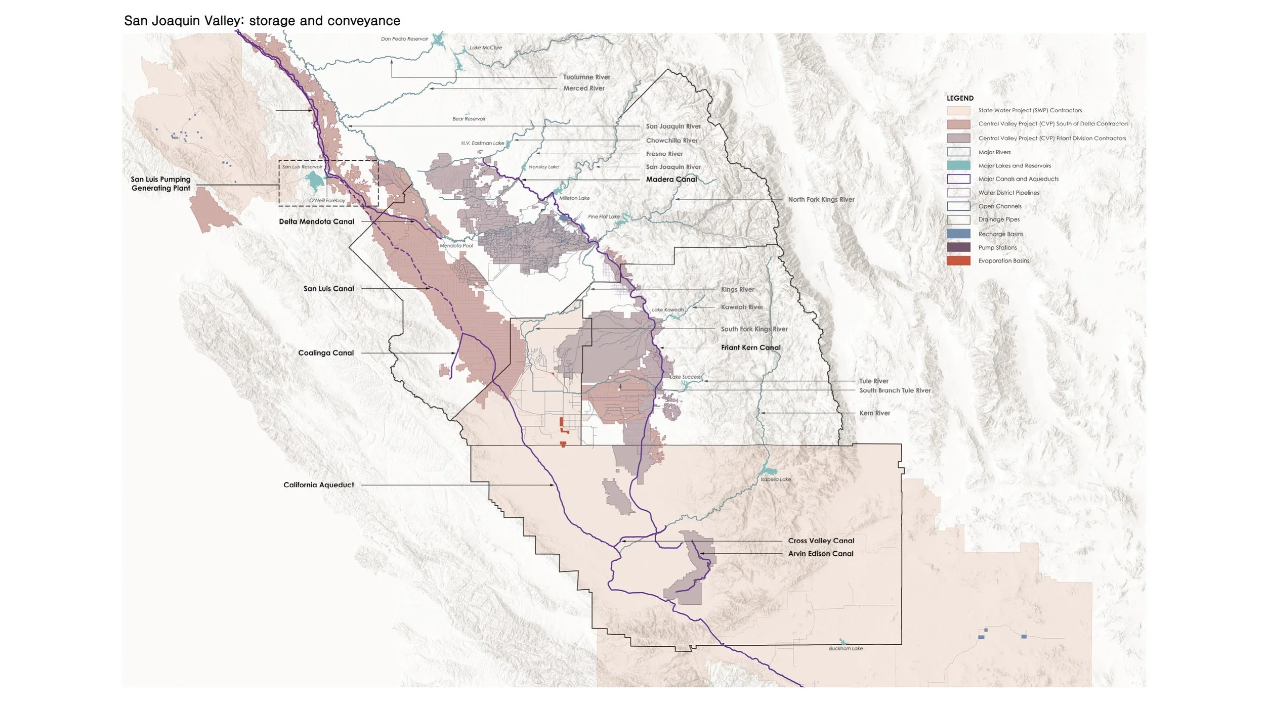
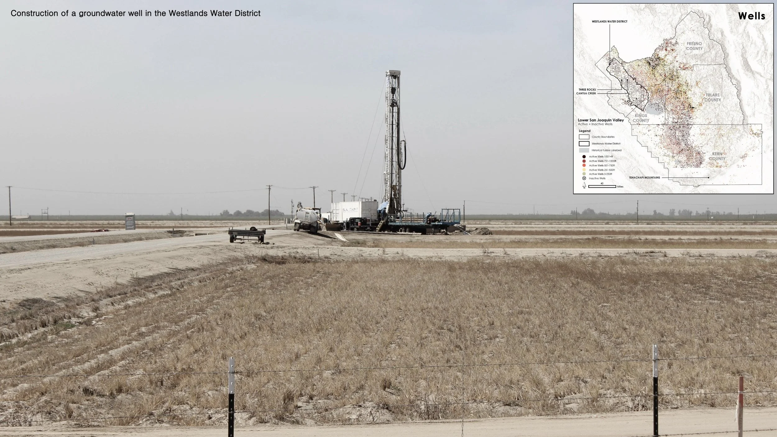
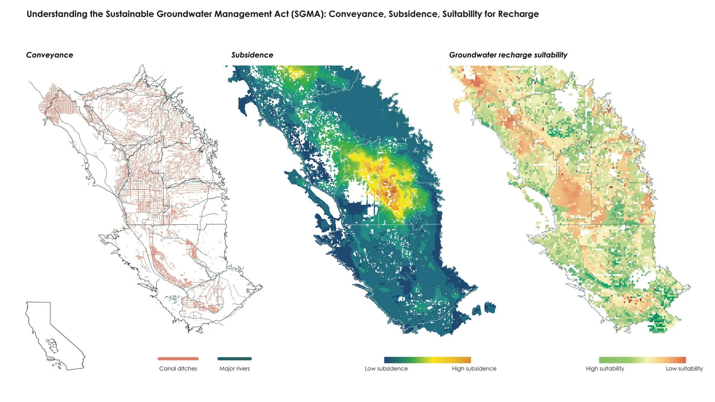
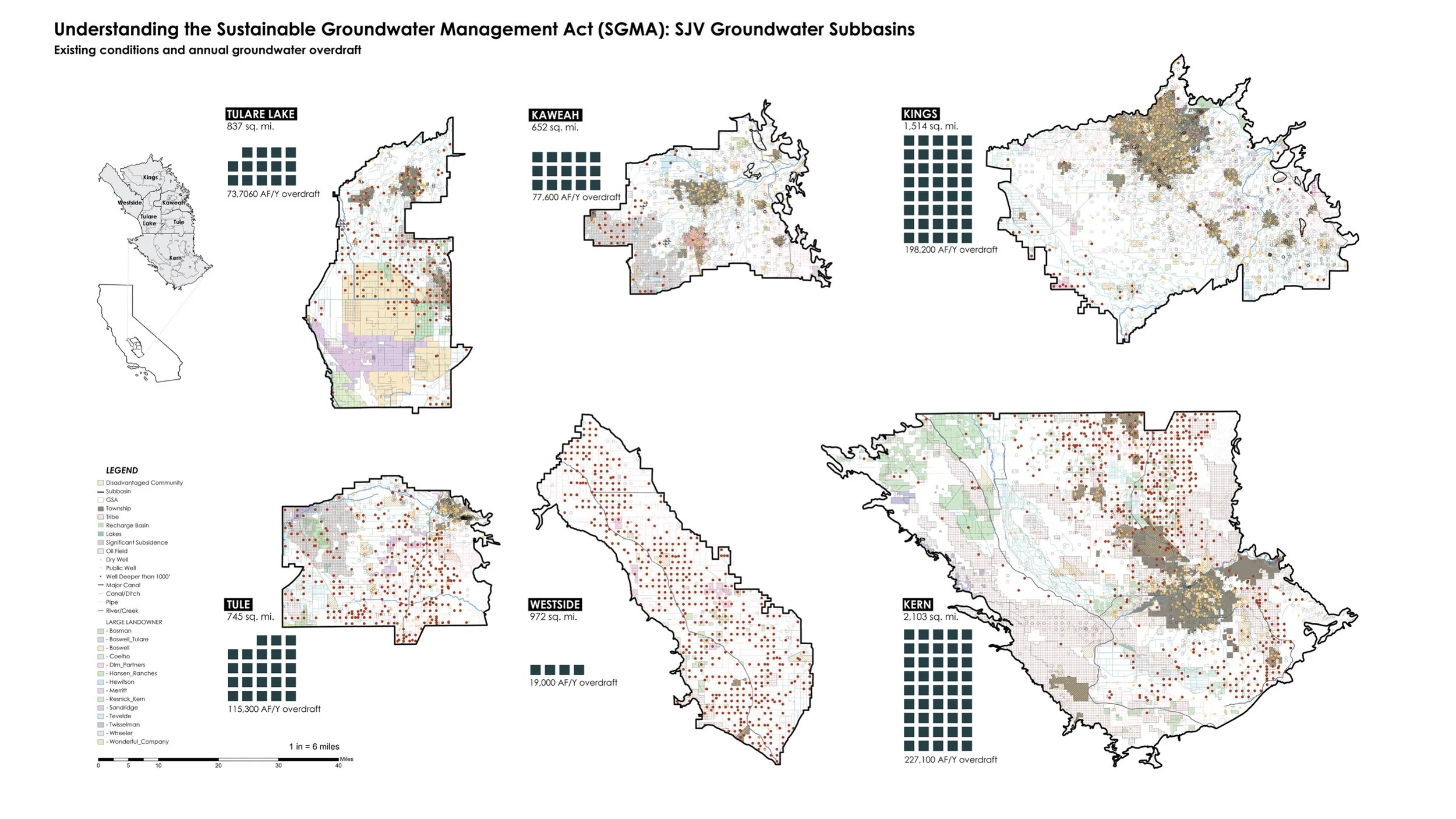
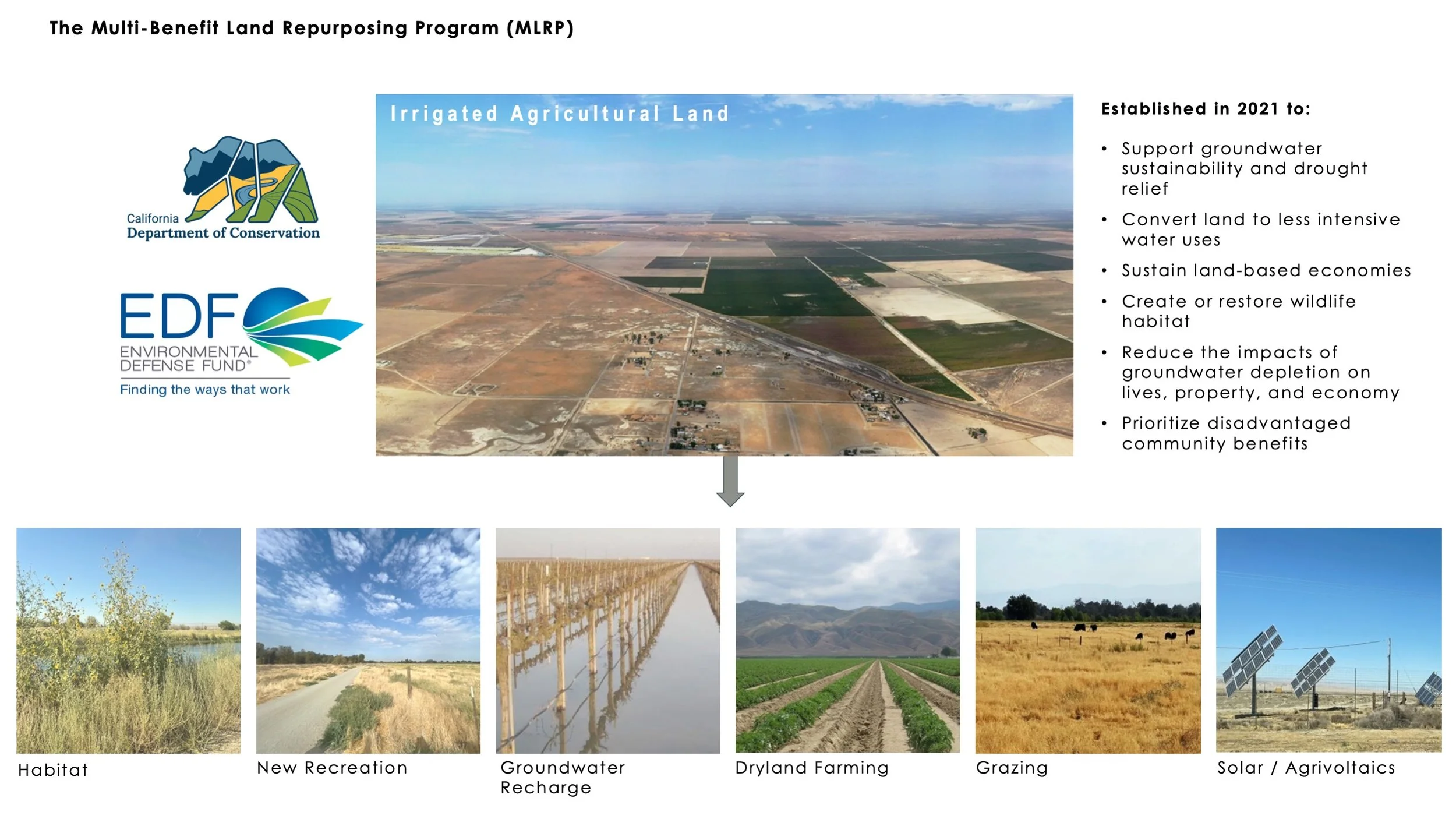
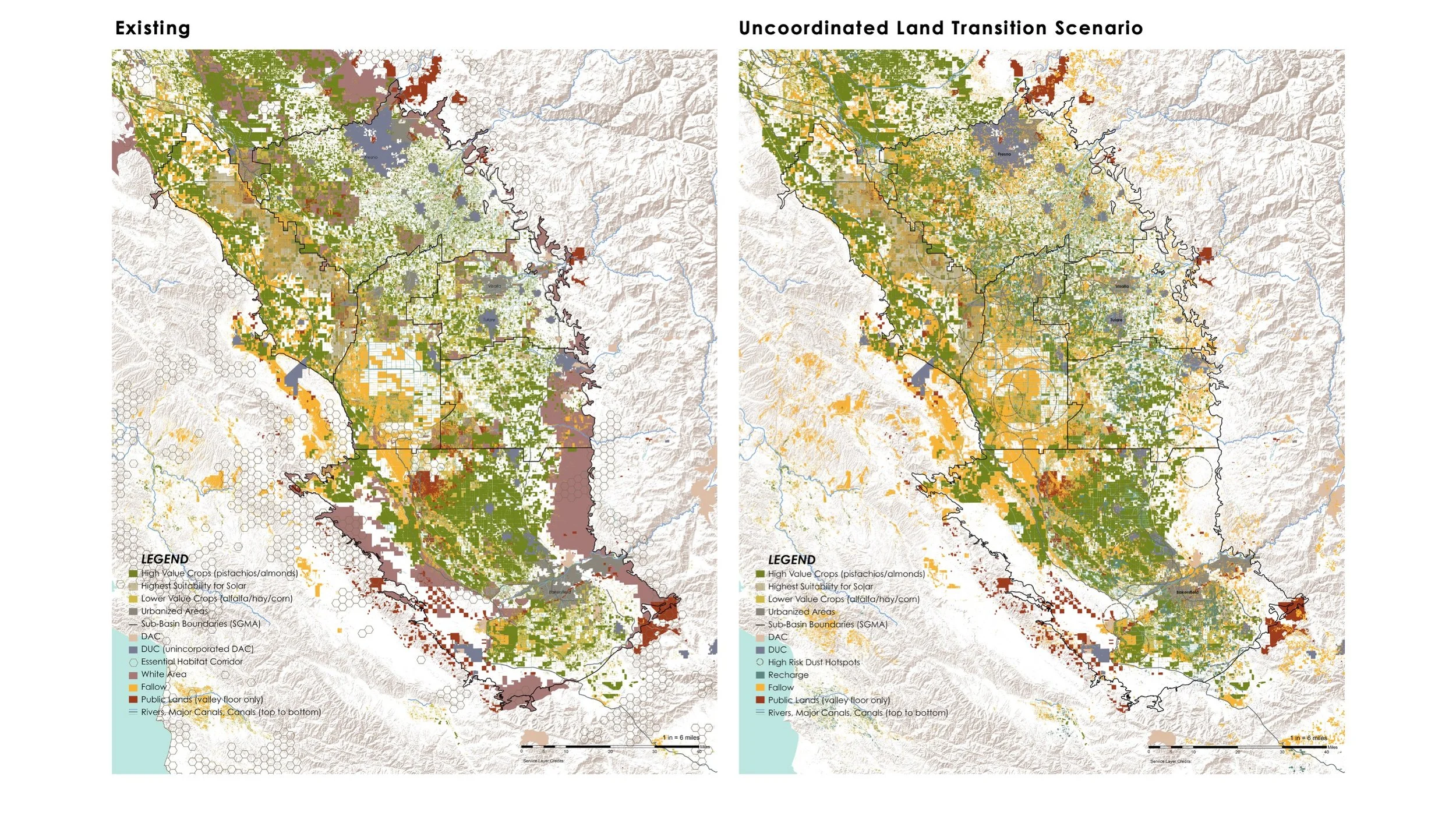
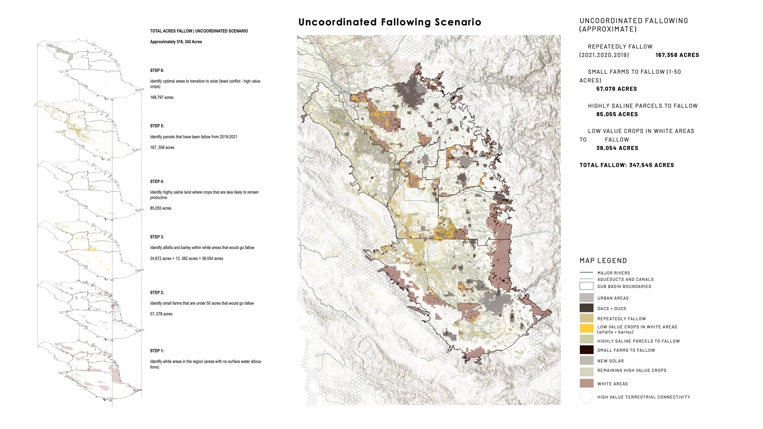
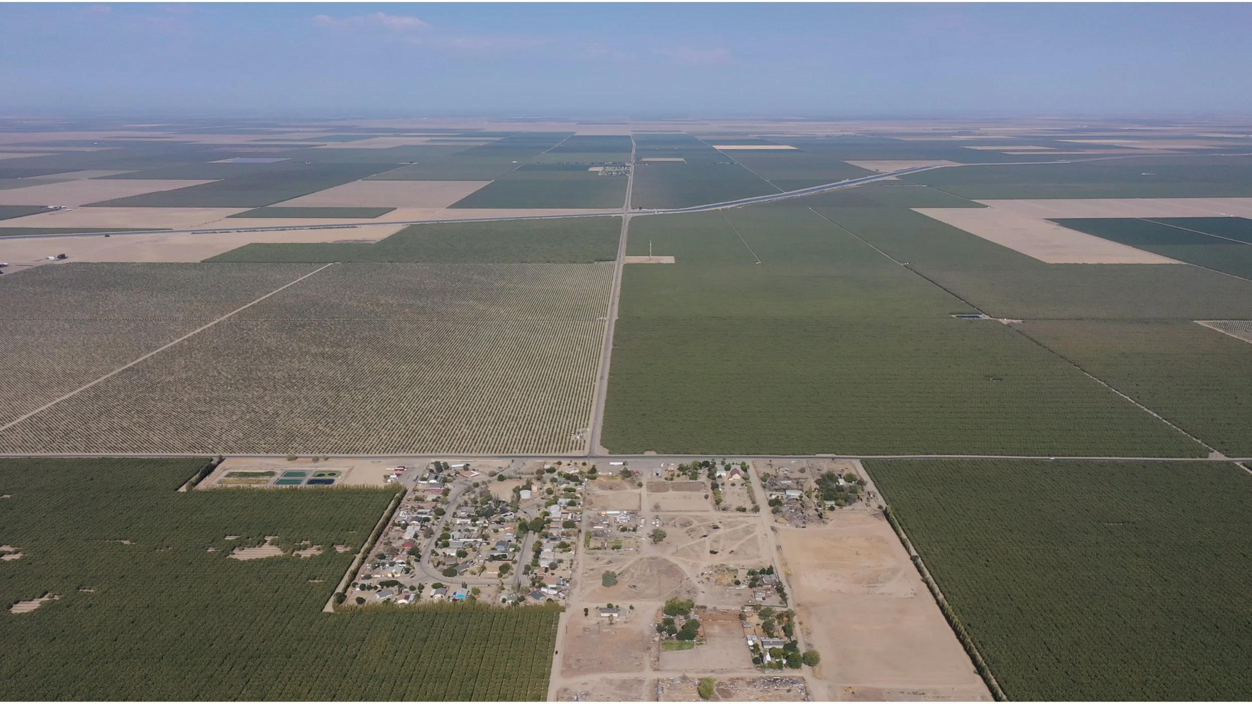
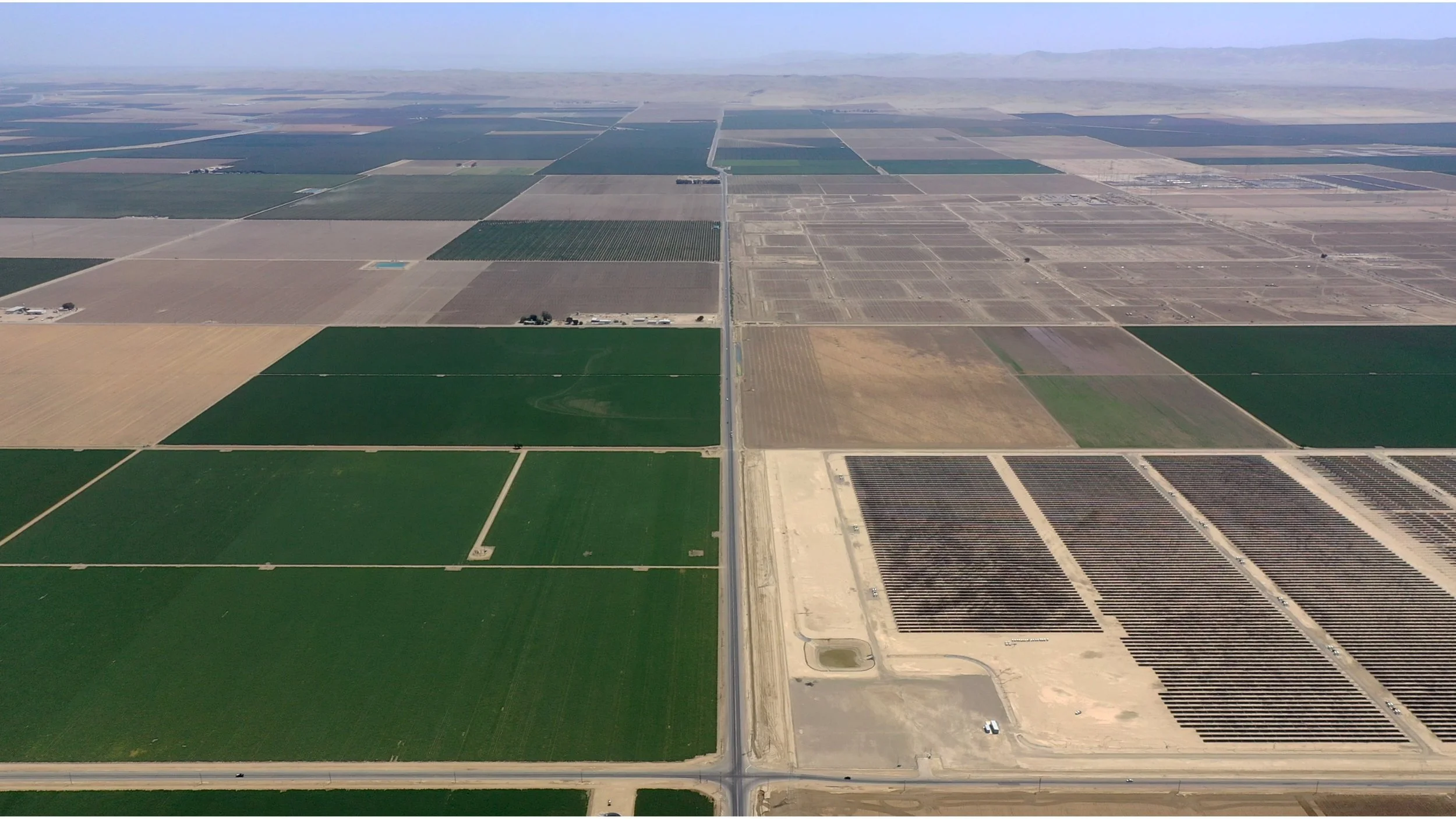
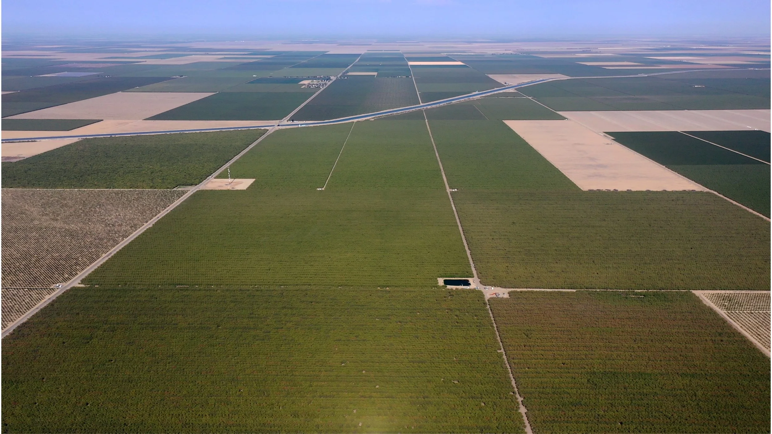
In partnership with the Environmental Defense Fund (EDF), this project developed a series of geospatial analyses, landscape visualizations, and future scenarios to support implementation of California’s Sustainable Groundwater Management Act (SGMA) and the state’s Multi-benefit Land Repurposing Program (MLRP). As California confronts the reality that an estimated 500,000 to one million acres of irrigated farmland will need to transition out of agricultural production to achieve groundwater sustainability, the project sought to make the environmental, economic, and community implications of these unprecedented land-use changes visible. Working across regional and local scales, the team developed scenario-based visualizations that illustrated both the consequences of uncoordinated land fallowing—including increased dust, habitat fragmentation, declining rural economies, and public health impacts—and the opportunities created through coordinated, multi-benefit land repurposing.
The work combined geospatial modeling, field investigation, stakeholder engagement, and landscape design to produce a series of compelling visual narratives that informed conversations among state agencies, nonprofit partners, local communities, and landowners navigating this transition. Rather than treating land retirement as a singular environmental challenge, the project demonstrated how coordinated planning could simultaneously advance groundwater recharge, habitat restoration, renewable energy, public open space, climate resilience, and more equitable futures for rural communities. By translating complex policy into accessible landscape scenarios, the project helped build understanding of the transformative potential of the MLRP and provided a framework for envisioning long-term landscape change across California’s San Joaquin Valley.